
Buchanan topographic map
Interactive map
Click on the map to display elevation.
About this map
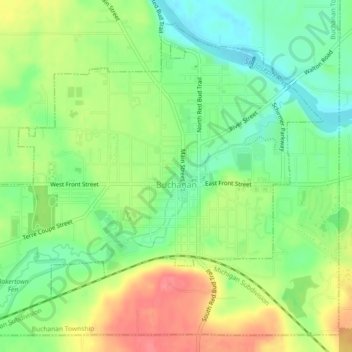
Name: Buchanan topographic map, elevation, terrain.
Location: Buchanan, Berrien County, Michigan, United States (41.81328 -86.38756 41.84290 -86.34206)
Average elevation: 728 ft
Minimum elevation: 623 ft
Maximum elevation: 869 ft