
Jasper topographic map
Interactive map
Click on the map to display elevation.
About this map
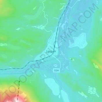
Name: Jasper topographic map, elevation, terrain.
Location: Jasper, Municipality of Jasper, Alberta, T0E 1E0, Canada (52.83523 -118.12243 52.91523 -118.04243)
Average elevation: 3,855 ft
Minimum elevation: 3,337 ft
Maximum elevation: 7,421 ft
Other topographic maps
Click on a map to view its topography, its elevation and its terrain.
Patricia Lake
Patricia Lake, Pyramid Lake Road, Jasper, Municipality of Jasper, Alberta, T0E 1E0, Canada
Average elevation: 3,881 ft