
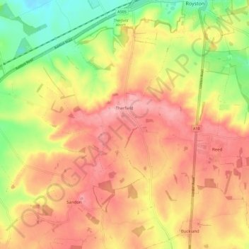
Therfield topographic map
Interactive map
Click on the map to display elevation.
About this map
Name: Therfield topographic map, elevation, terrain.
Average elevation: 400 ft
Minimum elevation: 167 ft
Maximum elevation: 564 ft
Other topographic maps
Click on a map to view its topography, its elevation and its terrain.
St Paul's Walden
United Kingdom > England > Hertfordshire > North Hertfordshire
St Paul's Walden, North Hertfordshire, Hertfordshire, England, United Kingdom
Average elevation: 397 ft
Hitchin
United Kingdom > England > Hertfordshire > North Hertfordshire
Hitchin, North Hertfordshire, Hertfordshire, England, SG5 1BB, United Kingdom
Average elevation: 299 ft
Barley
United Kingdom > England > Hertfordshire > North Hertfordshire
Barley, North Hertfordshire, Hertfordshire, England, United Kingdom
Average elevation: 338 ft