
Bancroft topographic map
Interactive map
Click on the map to display elevation.
About this map
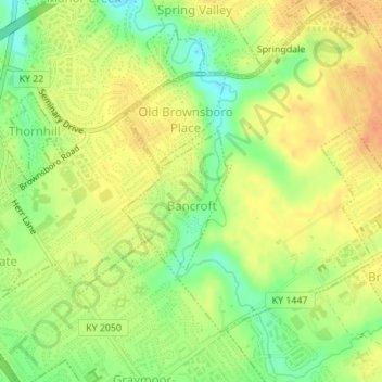
Name: Bancroft topographic map, elevation, terrain.
Location: Bancroft, Jefferson County, Kentucky, United States (38.27858 -85.61791 38.28970 -85.60801)
Average elevation: 600 ft
Minimum elevation: 522 ft
Maximum elevation: 659 ft