
Berford Lake topographic map
Interactive map
Click on the map to display elevation.
About this map
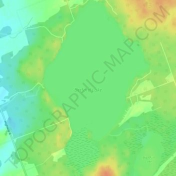
Name: Berford Lake topographic map, elevation, terrain.
Average elevation: 682 ft
Minimum elevation: 630 ft
Maximum elevation: 751 ft
Other topographic maps
Click on a map to view its topography, its elevation and its terrain.
Bruce Peninsula
Canada > Ontario > South Bruce Peninsula
Bruce Peninsula, Silver Lake Road, South Bruce Peninsula, Bruce County, Ontario, N0H 1P0, Canada
Average elevation: 715 ft
Sauble Falls
Canada > Ontario > South Bruce Peninsula
Sauble Falls, South Bruce Peninsula, Bruce County, Ontario, N0H 2G0, Canada
Average elevation: 623 ft