
Fox Ridge topographic map
Interactive map
Click on the map to display elevation.
About this map
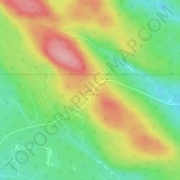
Name: Fox Ridge topographic map, elevation, terrain.
Average elevation: 1,677 ft
Minimum elevation: 1,480 ft
Maximum elevation: 1,919 ft
Other topographic maps
Click on a map to view its topography, its elevation and its terrain.
Grand Falls
Canada > New Brunswick > Victoria County
Grand Falls, Victoria County, New Brunswick, Canada
Average elevation: 584 ft
Aroostook
Canada > New Brunswick > Victoria County > Aroostook
Aroostook, Andover Parish, Victoria County, New Brunswick, Canada
Average elevation: 466 ft