
Oenpelli topographic map
Interactive map
Click on the map to display elevation.
About this map
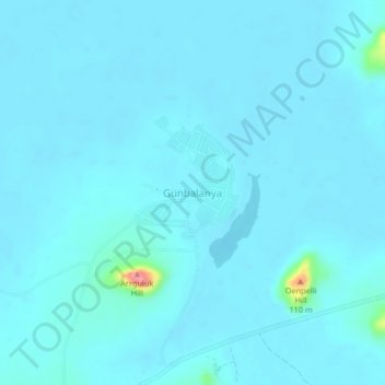
Name: Oenpelli topographic map, elevation, terrain.
Location: Oenpelli, Northern Territory, Australia (-12.34469 133.03362 -12.30469 133.07362)
Average elevation: 33 ft
Minimum elevation: 7 ft
Maximum elevation: 427 ft
Other topographic maps
Click on a map to view its topography, its elevation and its terrain.
Gunbalanya
Australia > Northern Territory > Oenpelli
Gunbalanya, Oenpelli, Northern Territory, Australia
Average elevation: 36 ft