
Mirabel topographic map
Interactive map
Click on the map to display elevation.
About this map
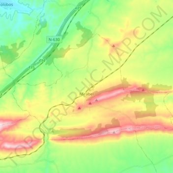
Name: Mirabel topographic map, elevation, terrain.
Location: Mirabel, Cáceres, Extremadura, 10540, Spain (39.83119 -6.29806 39.90148 -6.14919)
Average elevation: 1,476 ft
Minimum elevation: 856 ft
Maximum elevation: 2,431 ft