
Tenkawa topographic map
Interactive map
Click on the map to display elevation.
About this map
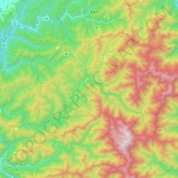
Name: Tenkawa topographic map, elevation, terrain.
Location: Tenkawa, Yoshino County, Nara Prefecture, Japan (34.17010 135.74279 34.29262 135.97316)
Average elevation: 2,917 ft
Minimum elevation: 659 ft
Maximum elevation: 6,184 ft