
Zakynthos topographic map
Interactive map
Click on the map to display elevation.
About this map
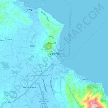
Name: Zakynthos topographic map, elevation, terrain.
Average elevation: 72 ft
Minimum elevation: -7 ft
Maximum elevation: 1,539 ft
Other topographic maps
Click on a map to view its topography, its elevation and its terrain.
Zakynthos
Greece > Peloponnese, Western Greece and the Ionian > Zakynthos Regional Unit
Zakynthos, Zakynthos Regional Unit, Ioanian Islands, Peloponnese, Western Greece and the Ionian, Greece
Average elevation: 269 ft