
Secteur 2 topographic map
Interactive map
Click on the map to display elevation.
About this map
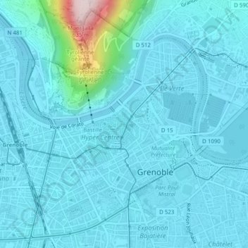
Name: Secteur 2 topographic map, elevation, terrain.
Average elevation: 804 ft
Minimum elevation: 669 ft
Maximum elevation: 2,077 ft
Other topographic maps
Click on a map to view its topography, its elevation and its terrain.
Secteur 4
France > Auvergne-Rhône-Alpes > Grenoble
Secteur 4, Grenoble, Isère, Auvergne-Rhône-Alpes, Metropolitan France, 38100, France
Average elevation: 722 ft