
Manu topographic map
Interactive map
Click on the map to display elevation.
About this map
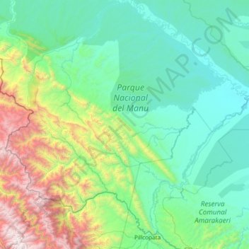
Name: Manu topographic map, elevation, terrain.
Location: Manu, Province of Manú, Madre de Dios, Peru (-12.96288 -72.07896 -11.81140 -70.92067)
Average elevation: 3,166 ft
Minimum elevation: 902 ft
Maximum elevation: 14,318 ft
Other topographic maps
Click on a map to view its topography, its elevation and its terrain.
Manu National Park
Peru > Madre de Dios > Manu
Manu National Park, Manu, Province of Manú, Madre de Dios, Peru
Average elevation: 3,301 ft