
Pedroso topographic map
Interactive map
Click on the map to display elevation.
About this map
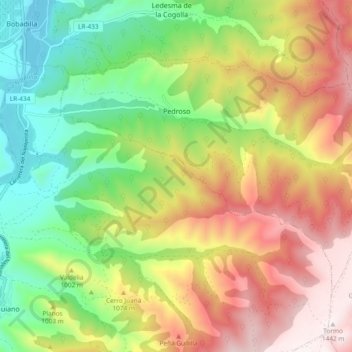
Name: Pedroso topographic map, elevation, terrain.
Location: Pedroso, La Rioja, España (42.26301 -2.74969 42.31176 -2.65563)
Average elevation: 3,130 ft
Minimum elevation: 1,814 ft
Maximum elevation: 4,741 ft