
Alt-Hohenschönhausen topographic map
Interactive map
Click on the map to display elevation.
About this map
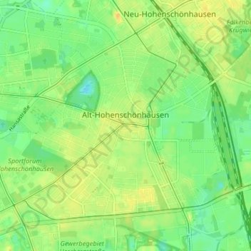
Name: Alt-Hohenschönhausen topographic map, elevation, terrain.
Location: Alt-Hohenschönhausen, Lichtenberg, Berlijn, Duitsland (52.53313 13.46708 52.56415 13.53226)
Average elevation: 187 ft
Minimum elevation: 144 ft
Maximum elevation: 226 ft
Other topographic maps
Click on a map to view its topography, its elevation and its terrain.
Siemensstadt
Siemensstadt, Spandau, Berlijn, 13629, Duitsland
Average elevation: 115 ft
Charlottenburg-Wilmersdorf
Charlottenburg-Wilmersdorf, Berlijn, Duitsland
Average elevation: 144 ft
Lichterfelde
Lichterfelde, Steglitz-Zehlendorf, Berlijn, Duitsland
Average elevation: 154 ft