
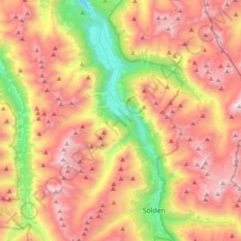
Längenfeld topographic map
Interactive map
Click on the map to display elevation.
About this map
Name: Längenfeld topographic map, elevation, terrain.
Location: Längenfeld, Imst, Tirol, 6444, Österreich (46.94434 10.88542 47.12167 11.11874)
Average elevation: 7,503 ft
Minimum elevation: 3,488 ft
Maximum elevation: 11,355 ft