
Harderwijk topographic map
Interactive map
Click on the map to display elevation.
About this map
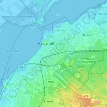
Name: Harderwijk topographic map, elevation, terrain.
Location: Harderwijk, Gelderland, Nederland (52.30154 5.56586 52.37884 5.71285)
Average elevation: 16 ft
Minimum elevation: -20 ft
Maximum elevation: 112 ft