
Lamphelpat topographic map
Interactive map
Click on the map to display elevation.
About this map
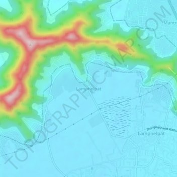
Name: Lamphelpat topographic map, elevation, terrain.
Location: Lamphelpat, Imphal West, Manipur, 795002, India (24.81541 93.89356 24.85541 93.93356)
Average elevation: 2,717 ft
Minimum elevation: 2,526 ft
Maximum elevation: 3,606 ft
Other topographic maps
Click on a map to view its topography, its elevation and its terrain.
Imphal
India > Manipur > Lamphelpat
Imphal, Lamphelpat, Imphal West District, Manipur, 795001, India
Average elevation: 2,825 ft