
Rio Mearim topographic map
Interactive map
Click on the map to display elevation.
About this map
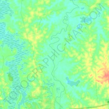
Name: Rio Mearim topographic map, elevation, terrain.
Average elevation: 59 ft
Minimum elevation: 20 ft
Maximum elevation: 157 ft
Other topographic maps
Click on a map to view its topography, its elevation and its terrain.
Seco das Mulatas
Brasil > Maranhão > Bacabal > Seco das Mulatas
Seco das Mulatas, Bacabal, Região Geográfica Imediata de Bacabal, Região Geográfica Intermediária de Santa Inês-Bacabal, Maranhão, Região Nordeste, Brasil
Average elevation: 36 ft