
Yagan topographic map
Interactive map
Click on the map to display elevation.
About this map
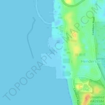
Name: Yagan topographic map, elevation, terrain.
Location: Yagan, Perth, Western Australia, Australia (-32.16064 115.76570 -32.16012 115.76680)
Average elevation: 16 ft
Minimum elevation: -16 ft
Maximum elevation: 112 ft
Other topographic maps
Click on a map to view its topography, its elevation and its terrain.
Hyde Park
Australia > Western Australia > Perth
Hyde Park, Highgate, Perth, Western Australia, Australia
Average elevation: 82 ft
Lesley
Australia > Western Australia > Perth
Lesley, Perth, Western Australia, Australia
Average elevation: 850 ft
Falls Farm
Australia > Western Australia > Perth
Falls Farm, Lesmurdie, Perth, Western Australia, Australia
Average elevation: 902 ft