
Acherkogel topographic map
Interactive map
Click on the map to display elevation.
About this map
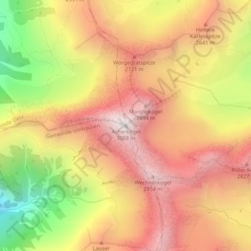
Name: Acherkogel topographic map, elevation, terrain.
Location: Acherkogel, Umhausen, Imst, Tirol, Österreich (47.18916 10.95660 47.18926 10.95670)
Average elevation: 7,959 ft
Minimum elevation: 5,397 ft
Maximum elevation: 9,741 ft