
River Cray topographic map
Interactive map
Click on the map to display elevation.
About this map
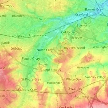
Name: River Cray topographic map, elevation, terrain.
Average elevation: 164 ft
Minimum elevation: 3 ft
Maximum elevation: 361 ft
Other topographic maps
Click on a map to view its topography, its elevation and its terrain.
Darent
United Kingdom > England > Kent > London
Darent, London, Kent, Greater London, England, United Kingdom
Average elevation: 302 ft