
Stevensville topographic map
Interactive map
Click on the map to display elevation.
About this map
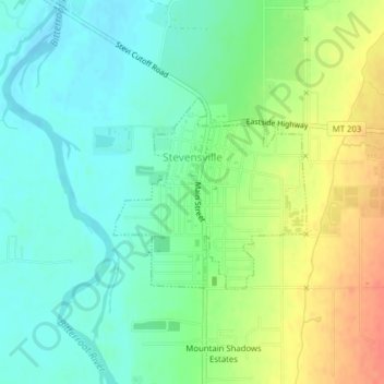
Name: Stevensville topographic map, elevation, terrain.
Location: Stevensville, Ravalli County, Montana, United States (46.50117 -114.10248 46.51462 -114.08275)
Average elevation: 3,323 ft
Minimum elevation: 3,264 ft
Maximum elevation: 3,422 ft