
Geluwe topographic map
Interactive map
Click on the map to display elevation.
About this map
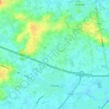
Name: Geluwe topographic map, elevation, terrain.
Location: Geluwe, Wervik, Ieper, West Flanders, Flanders, Belgium (50.79978 3.02544 50.85400 3.10738)
Average elevation: 82 ft
Minimum elevation: 52 ft
Maximum elevation: 164 ft