
Lake Volta topographic map
Interactive map
Click on the map to display elevation.
About this map
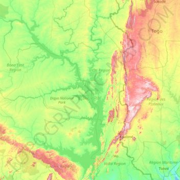
Name: Lake Volta topographic map, elevation, terrain.
Location: Lake Volta, Brong-Ahafo Region, Ghana (6.24184 -1.49562 8.99970 0.32789)
Average elevation: 636 ft
Minimum elevation: 0 ft
Maximum elevation: 3,071 ft
Other topographic maps
Click on a map to view its topography, its elevation and its terrain.
Premoase
Ghana > Brong-Ahafo Region > Premoase
Premoase, Brong-Ahafo Region, Ghana
Average elevation: 436 ft