
Kutum topographic map
Interactive map
Click on the map to display elevation.
About this map
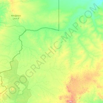
Name: Kutum topographic map, elevation, terrain.
Location: Kutum, North Darfur State, Sudan (13.79437 22.78123 16.49755 25.42339)
Average elevation: 2,933 ft
Minimum elevation: 2,100 ft
Maximum elevation: 7,402 ft
Other topographic maps
Click on a map to view its topography, its elevation and its terrain.
Sai Osru
Sudan > North Darfur State > Kutum
Sai Osru, Kutum, North Darfur State, Sudan
Average elevation: 3,445 ft