
Ruthin topographic map
Interactive map
Click on the map to display elevation.
About this map
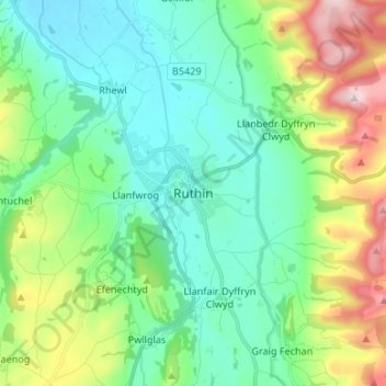
Name: Ruthin topographic map, elevation, terrain.
Location: Ruthin, Denbighshire, Wales, LL15 1BU, United Kingdom (53.07155 -3.34524 53.15155 -3.26524)
Average elevation: 531 ft
Minimum elevation: 115 ft
Maximum elevation: 1,657 ft