
Lobuche topographic map
Interactive map
Click on the map to display elevation.
About this map
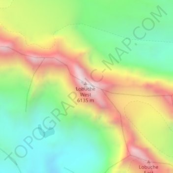
Name: Lobuche topographic map, elevation, terrain.
Average elevation: 17,976 ft
Minimum elevation: 16,447 ft
Maximum elevation: 20,121 ft
Other topographic maps
Click on a map to view its topography, its elevation and its terrain.
Island Peak
Nepal > Eastern Development Region > Khumjung
Island Peak, Khumjung, Khumbupasanglahmu, Solukhumbu, Province #1, Nepal
Average elevation: 17,917 ft