
Herval topographic map
Interactive map
Click on the map to display elevation.
About this map
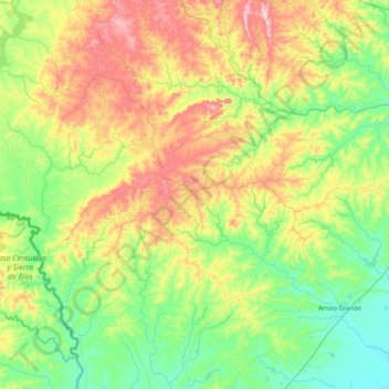
Name: Herval topographic map, elevation, terrain.
Average elevation: 499 ft
Minimum elevation: 26 ft
Maximum elevation: 1,562 ft
Herval is a Brazilian municipality in the southern part of the state of Rio Grande do Sul. The population is 6,975 (2015 est.) in an area of 1757.84 km². Its elevation is 287 m. Its main industry is agriculture.