
Eriboll topographic map
Interactive map
Click on the map to display elevation.
About this map
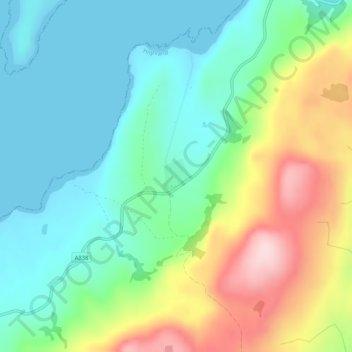
Name: Eriboll topographic map, elevation, terrain.
Location: Eriboll, Highland, Scotland, IV27 4UL, United Kingdom (58.46650 -4.69113 58.46923 -4.68691)
Average elevation: 305 ft
Minimum elevation: 0 ft
Maximum elevation: 948 ft
Other topographic maps
Click on a map to view its topography, its elevation and its terrain.
Am Feur- loch
United Kingdom > Scotland > Eriboll
Am Feur- loch, A838, Eriboll, Highland, Scotland, IV27 4UL, United Kingdom
Average elevation: 502 ft