
Azogues topographic map
Interactive map
Click on the map to display elevation.
About this map
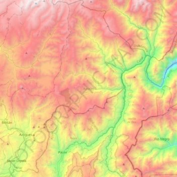
Name: Azogues topographic map, elevation, terrain.
Location: Azogues, Cañar, Ecuador (-2.83666 -78.92389 -2.42662 -78.56794)
Average elevation: 10,000 ft
Minimum elevation: 4,928 ft
Maximum elevation: 14,544 ft
Other topographic maps
Click on a map to view its topography, its elevation and its terrain.
San Miguel de Porotos
San Miguel de Porotos, San Miguel, Azogues, Cañar, 030154, Ecuador
Average elevation: 8,740 ft