
Mt. Hermon topographic map
Interactive map
Click on the map to display elevation.
About this map
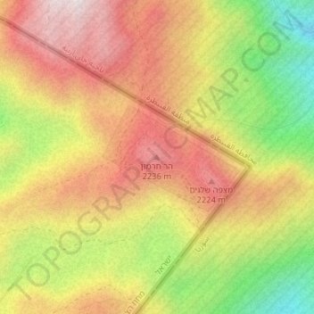
Name: Mt. Hermon topographic map, elevation, terrain.
Location: Mt. Hermon, Golan Regional Council, North District, Israel (33.31775 35.80356 33.31785 35.80366)
Average elevation: 6,614 ft
Minimum elevation: 5,285 ft
Maximum elevation: 7,667 ft
Other topographic maps
Click on a map to view its topography, its elevation and its terrain.
Golan Heights
Israel > North District > Golan Regional Council
Golan Heights, Golan Regional Council, Golan Heights Subdistrict, North District, Israel
Average elevation: 1,749 ft
Mount Hermon
Israel > North District > Golan Regional Council
Mount Hermon, Golan Regional Council, Golan Heights Subdistrict, North District, Israel
Average elevation: 5,712 ft