
Friendship topographic map
Interactive map
Click on the map to display elevation.
About this map
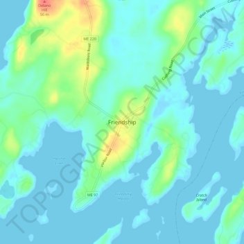
Name: Friendship topographic map, elevation, terrain.
Location: Friendship, Knox County, Maine, 04547, United States (43.96392 -69.35403 44.00392 -69.31403)
Average elevation: 36 ft
Minimum elevation: -10 ft
Maximum elevation: 177 ft