
Tacaná topographic map
Interactive map
Click on the map to display elevation.
About this map
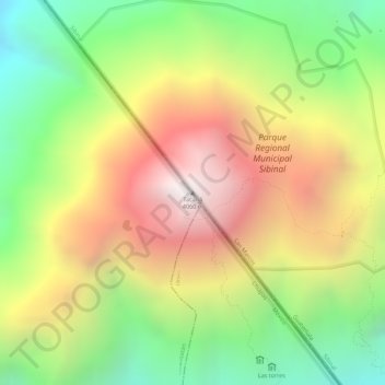
Name: Tacaná topographic map, elevation, terrain.
Location: Tacaná, Sibinal, San Marcos, Guatemala (15.13243 -92.10847 15.13253 -92.10837)
Average elevation: 11,417 ft
Minimum elevation: 9,459 ft
Maximum elevation: 13,366 ft
The second route is from the Mexican side, from El Carmen, Talismán bridge, Cacahoatán, and Unión Juárez by vehicle, and from there on foot. This route passes into Guatemala and has been described as one of the most interesting hikes in Central America, leading up winding paths through lush rainforests, subsistence farming villages, up ancient magma flows, and rock-filled temperate forests before reaching the top of the lowest caldera. From there the final stretch to the summit provides panoramic views high above the clouds as the tree line gradually diminishes with altitude. Several major volcanos within the Central American Volcanic Arch including Tajumulco are visible from the summit.