
El Khroub topographic map
Interactive map
Click on the map to display elevation.
About this map
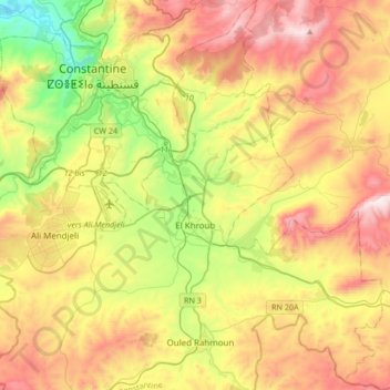
Name: El Khroub topographic map, elevation, terrain.
Location: El Khroub, El Khroub District, Constantine, Algeria (36.14596 6.52637 36.41680 6.78243)
Average elevation: 2,523 ft
Minimum elevation: 1,033 ft
Maximum elevation: 4,311 ft
Other topographic maps
Click on a map to view its topography, its elevation and its terrain.
Ali Mendjeli
Algeria > Constantine > El Khroub District
Ali Mendjeli, El Khroub, El Khroub District, Constantine, 25005, Algeria
Average elevation: 2,451 ft