
Spitamen District topographic map
Interactive map
Click on the map to display elevation.
About this map
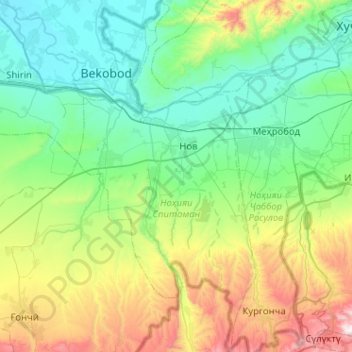
Name: Spitamen District topographic map, elevation, terrain.
Location: Spitamen District, Sughd Region, 735830, Tajikistan (39.92166 69.21133 40.31256 69.47115)
Average elevation: 2,057 ft
Minimum elevation: 912 ft
Maximum elevation: 5,627 ft
Other topographic maps
Click on a map to view its topography, its elevation and its terrain.
Panjakent District
Panjakent District, Sughd Region, Tajikistan
Average elevation: 7,956 ft
Khujand
Tajikistan > Sughd Region > Ghafurov District
Khujand, Ghafurov District, Sughd Region, 735700, Tajikistan
Average elevation: 1,617 ft