
Bourem Cercle topographic map
Interactive map
Click on the map to display elevation.
About this map
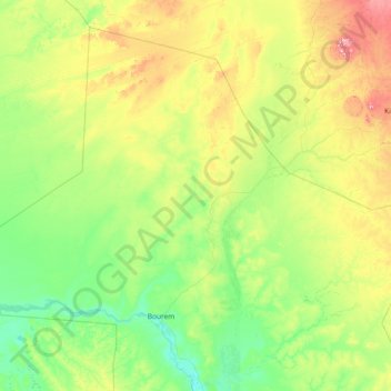
Name: Bourem Cercle topographic map, elevation, terrain.
Location: Bourem Cercle, Gao, Mali (16.61188 -1.70700 19.03900 1.24862)
Average elevation: 1,119 ft
Minimum elevation: 814 ft
Maximum elevation: 2,513 ft