
Poungui topographic map
Interactive map
Click on the map to display elevation.
About this map
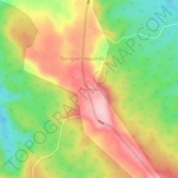
Name: Poungui topographic map, elevation, terrain.
Location: Poungui, Ogooué-Lolo, Gabon (-0.89910 12.71350 -0.85910 12.75350)
Average elevation: 1,608 ft
Minimum elevation: 1,165 ft
Maximum elevation: 2,057 ft