
Ereğli topographic map
Interactive map
Click on the map to display elevation.
About this map
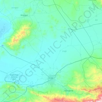
Name: Ereğli topographic map, elevation, terrain.
Location: Ereğli, Konya, Central Anatolia Region, Turkey (37.34902 33.74957 38.01870 34.38000)
Average elevation: 4,144 ft
Minimum elevation: 3,271 ft
Maximum elevation: 11,070 ft
Other topographic maps
Click on a map to view its topography, its elevation and its terrain.