Badrinath topographic map
Interactive map
Click on the map to display elevation.
About this map
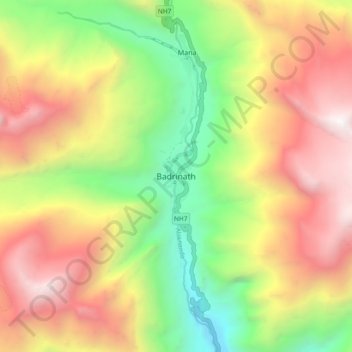
Name: Badrinath topographic map, elevation, terrain.
Average elevation: 13,294 ft
Minimum elevation: 8,809 ft
Maximum elevation: 18,176 ft

Click on the map to display elevation.
Name: Badrinath topographic map, elevation, terrain.
Average elevation: 13,294 ft
Minimum elevation: 8,809 ft
Maximum elevation: 18,176 ft