
Ordino topographic map
Interactive map
Click on the map to display elevation.
About this map
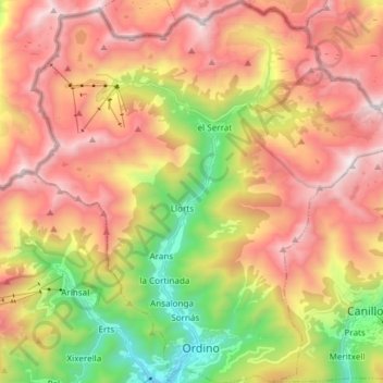
Name: Ordino topographic map, elevation, terrain.
Location: Ordino, AD300, Andorra (42.54585 1.46802 42.65594 1.60745)
Average elevation: 6,916 ft
Minimum elevation: 4,055 ft
Maximum elevation: 9,534 ft
Other topographic maps
Click on a map to view its topography, its elevation and its terrain.
Andorra la Vella
Andorra > Andorra la Vella > Andorra la Vella
Andorra la Vella, AD500, Andorra
Average elevation: 5,315 ft
Andorra la Vella
Andorra > Andorra la Vella > Andorra la Vella
Andorra la Vella, AD500, Andorra
Average elevation: 4,167 ft