
Dagana topographic map
Interactive map
Click on the map to display elevation.
About this map
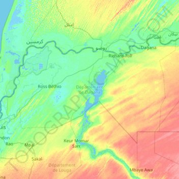
Name: Dagana topographic map, elevation, terrain.
Location: Dagana, Saint-Louis, Senegal (15.92548 -16.47713 16.59119 -15.33302)
Average elevation: 49 ft
Minimum elevation: -10 ft
Maximum elevation: 164 ft
Other topographic maps
Click on a map to view its topography, its elevation and its terrain.