
Port-Bouët topographic map
Interactive map
Click on the map to display elevation.
About this map
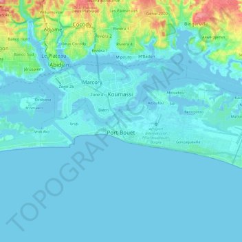
Name: Port-Bouët topographic map, elevation, terrain.
Location: Port-Bouët, Abidjan, 12, Côte d'Ivoire (5.22690 -4.03424 5.30778 -3.80864)
Average elevation: 39 ft
Minimum elevation: -16 ft
Maximum elevation: 351 ft