
Onna topographic map
Interactive map
Click on the map to display elevation.
About this map
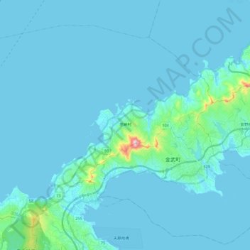
Name: Onna topographic map, elevation, terrain.
Location: Onna, Kunigami, Okinawa Prefecture, Japan (26.41514 127.72474 26.57040 127.94097)
Average elevation: 69 ft
Minimum elevation: 0 ft
Maximum elevation: 1,155 ft
Other topographic maps
Click on a map to view its topography, its elevation and its terrain.