
Nageezi topographic map
Interactive map
Click on the map to display elevation.
About this map
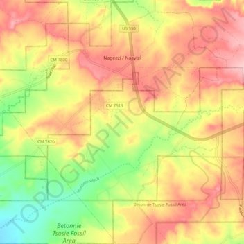
Name: Nageezi topographic map, elevation, terrain.
Location: Nageezi, San Juan County, New Mexico, 87037, United States (36.20508 -107.79228 36.28574 -107.70261)
Average elevation: 6,834 ft
Minimum elevation: 6,542 ft
Maximum elevation: 7,064 ft