
Green Ville topographic map
Interactive map
Click on the map to display elevation.
About this map
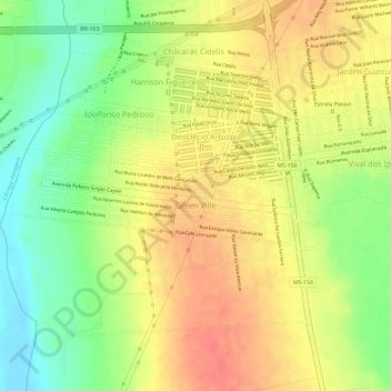
Name: Green Ville topographic map, elevation, terrain.
Average elevation: 1,306 ft
Minimum elevation: 1,194 ft
Maximum elevation: 1,381 ft
Other topographic maps
Click on a map to view its topography, its elevation and its terrain.
Jardim Londrina
Brazil > Mato Grosso do Sul > Dourados
Jardim Londrina, Dourados, Microrregião de Dourados, Mesorregião Sudoeste de Mato Grosso do Sul, Mato Grosso do Sul, Central-West Region, Brazil
Average elevation: 1,401 ft