Dudh Pokhari topographic map
Interactive map
Click on the map to display elevation.
About this map
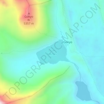
Name: Dudh Pokhari topographic map, elevation, terrain.
Average elevation: 16,004 ft
Minimum elevation: 15,427 ft
Maximum elevation: 17,963 ft

Click on the map to display elevation.
Name: Dudh Pokhari topographic map, elevation, terrain.
Average elevation: 16,004 ft
Minimum elevation: 15,427 ft
Maximum elevation: 17,963 ft