
Karimun topographic map
Interactive map
Click on the map to display elevation.
About this map
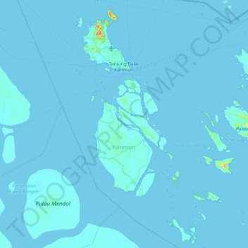
Name: Karimun topographic map, elevation, terrain.
Location: Karimun, Riau Islands, Indonesia (0.47247 103.28431 1.19170 103.98049)
Average elevation: 10 ft
Minimum elevation: -7 ft
Maximum elevation: 1,270 ft
Other topographic maps
Click on a map to view its topography, its elevation and its terrain.
Binga
Indonesia > Riau Islands > Karimun
Binga, Karimun, Riau Islands, Indonesia
Average elevation: 13 ft
Pait
Indonesia > Riau Islands > Karimun > Keban
Pait, Keban, Karimun, Riau Islands, Indonesia
Average elevation: 13 ft