
Chappell Hill topographic map
Interactive map
Click on the map to display elevation.
About this map
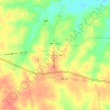
Name: Chappell Hill topographic map, elevation, terrain.
Average elevation: 272 ft
Minimum elevation: 174 ft
Maximum elevation: 341 ft
Other topographic maps
Click on a map to view its topography, its elevation and its terrain.
Brenham
United States > Texas > Washington County
Brenham, Washington County, Texas, United States
Average elevation: 322 ft
Independence
United States > Texas > Washington County > Independence
Independence, Washington County, Texas, United States
Average elevation: 348 ft
Burton
United States > Texas > Washington County
Burton, Washington County, Texas, United States
Average elevation: 433 ft