
Sarah topographic map
Interactive map
Click on the map to display elevation.
About this map
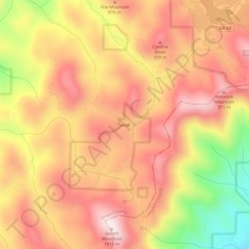
Name: Sarah topographic map, elevation, terrain.
Location: Sarah, Union County, Georgia, United States of America (34.64759 -84.05575 34.68759 -84.01575)
Average elevation: 2,707 ft
Minimum elevation: 1,719 ft
Maximum elevation: 3,301 ft