
Goiatuba topographic map
Interactive map
Click on the map to display elevation.
About this map
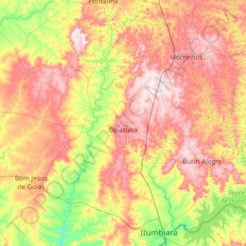
Name: Goiatuba topographic map, elevation, terrain.
Average elevation: 2,100 ft
Minimum elevation: 1,368 ft
Maximum elevation: 3,054 ft
The average elevation is 775 meters, with an annual temperature average of 22 °C. The climate is typically tropical, moist and hot, with well-defined dry and rainy seasons. Average temperatures vary between 19 °C and 30 °C.